One of our senior employee and expert in photography from my C ompany was planning to visit Rajgad last Sunday
(September 16, 2012). He asked one of our fellow Photography C lub members and so the link was created and we 7 of
us accompanied Mr. Vivek Kale for the Rajgad expedition - my first.
I reached Alka TalkiesC howk at 5.00
am. I was picked by a Santro by 5.30 am. The other C ar (Vista ) was
coming from the Bangalore Bypass. We took the Sinhagad Road
A little ahead of Khanapur (खानापुर), there is a road ascending upwards on Left. Sign-board for Velhe, Torna (वेल्हे, तोरणा) is available. We took that road. This is a very small road that goes turning through dense cover of trees. We were just a bit ahead when a sudden lightening struck on us. We came to know that we had forgotten to fill petrol. The needle had already crossed below "Empty". There was no way we could reach a petrol pump ahead. It was 6 am in the morning. We decided to turn back. We came all the way till Donje Phata.C ame
across 2 pumps - HP and Essar - both closed. We woke up the person at Essar,
requested him to help us out. After 10 minutes we were back on our track.
We were cruising through the small road with doing our bit of bird watching - we came across various species like Yellow Wagtail, Moor-hen, a type of a Dove. After a small "very bad" patch of mud, we started to ascend the Pabe Ghat (पाबे घाट). And another lightening struck us. We had a puncture. And the worst of it --> our spare tyre had less air pressure. It was 7.45 am.
Our another vehicle had gone ahead of us. We called them back. They took both of our tyres to a town ahead - Velhe. They came back after about one and half hours.
Once ready, we started off again at 9.30 am; hoping this time that nothing unworthy happens now which would lose more time for us.
After Paabe Ghat, comes a "T" joint to a main road. Right goes to Velhe while left to Nasarapur (नसरापुर). We took left. There is an Emu Farm on your left. You can see Emus wandering behind the fence. After 2-3 kms, there comes one road on the right. Better to inquire with the locals about the road to Rajgad via Vazeghar (वाझेघर) village towards Pali Darwaza atop.
Please note that there is one more route from Gunjawani (गुंजवणी) village. However, this trek is slightly difficult with one small rock-patch in between; railings are available though.
Nearby Vajeghar, we saw a spot filled with bright yellow flowers - Smithia Hirsuta. Seemed as if, Kaas that eloped us during our last month's visit there, had appeared here to compensate. The whole area was filled with tiny yellow flowers with a dot of red at the centre. The characteristic of Smithias is that these flowers blossom daily in the morning while close by 11.00-12.00 noon.
By 10.30 am we reached base of
the fort, a village by the name Pali. After full snacks of Kanda-pohe and C haha (tea in Marathi) - which was most required
because we all were feeling extremely hungry by then - we started our trek at
11.00 am. Initially it is midly steep walk-way, about 7-8 feet wide, pretty
plain. There was waterfall in between, view of which refreshed our mind.
Then comes a small flat land. There is an
information board mentioning a brief history and the map of the fort.
From here the actual trek and so the slightly tough part starts. There are some slippery patches in between, might have been formed due to rains. There was a stream of water coming down nearby, which must be getting into those waterfalls we saw at the base.
Trekking up this fort looking at the mighty bastions and walls at the top, with the rhythmic sound of water falls, green cover of trees around, red soil below and the grand Torna (तोरणा) Fort to guard your back - experience is priceless. On your left you can see the Suvela Maachi (सुवेळा माची) spreading ahead with its typical Nedhe (नेढे - Marathi word for a large hole formed within the rocks due to strong and cutting winds). On the right is the mighty Sanjeevani (संजीवनी) Maachi
Maachi actually is small and
narrow plateau which runs from the main fort towards its sides. It was used in
those days to keep a vigil around the area and track movements, if any, below.
A Maachi normally is strengthened with stone walls and bastions and loaded with
cannons at strategic locations. Sometimes there is a Gate (Darwaza) also.
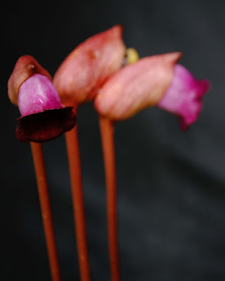
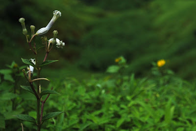
On our way we could find out many wild flowers of Sahyadris.
We were at the Pali Darwaza (पाली दरवाजा) by
1.00 pm. We were much delayed on account of the fuel and puncture incidents in
the morning. We had planned that we would start climbing at 8.30 am. Hence, we
decided to skip Suvela Machi and the C itadel. Instead we marched towards Sanjeevani Machi, the most beautiful and a photogenic place.
After you enter inside Pali Darwaza, there is an inscription (शीलालेख) in Modi script on the right wall. I tried to get the meaning from internet. Not yet succeeded. Once after Pali Darwaza, one lands on the Padmavati (पद्मावती) Maachi. There is a small direction map showing the way. On left is Goddess Padmavati Temple. Towards right are the Citadel and other two Maachis. For Sanjeevani Maachi, you need to go to right around the Citadel. The path is extremely narrow; hardly one person can walk, with steep and rocky walls of the Citadel on left and a deadly valley on right. Stone steps curving through the greens is seen below. About half a km later, one reaches the half-way to the Maachi. The view is awesome. It just eats away the fatigue and tiredness that you may be feeling. It lives upto its name - provides you Sanjeevani from fatigue.
We had our own refueling with the food that we had brought with us here. After about an hour spending here capturing the splendid view here and trying to capture as much as possible in our eyes we turned back.
We had a brief photography concepts discussion on the way and by 4.30 pm we were back near Pali Darwaza. We went straight towards Padmavati Goddess Temple. It is a small temple which one might confuse to be a small house. Inside is the idol of Goddess Padmavati, by whose name the Maachi is also known. Insides of the temple is extremely dark. People who do the overnight Rajgad trek, normally stay in this temple for the night.
After a brief stop here and some time spent for a group photo, we started to ascend at 5.30 pm. Should thank Mr. Vivek Kale for this awesome Group Snap at the Pali Darwaza.
It took us about an hour to reach the waterfalls below. After a final photography stop again and a cup of tea at the village, we proceeded for our return journey at 7.30 pm. I reached my home by 9.00 pm.
The place is about 70 kms from Pune.
Route Map:
I reached Alka Talkies
A little ahead of Khanapur (खानापुर), there is a road ascending upwards on Left. Sign-board for Velhe, Torna (वेल्हे, तोरणा) is available. We took that road. This is a very small road that goes turning through dense cover of trees. We were just a bit ahead when a sudden lightening struck on us. We came to know that we had forgotten to fill petrol. The needle had already crossed below "Empty". There was no way we could reach a petrol pump ahead. It was 6 am in the morning. We decided to turn back. We came all the way till Donje Phata.
We were cruising through the small road with doing our bit of bird watching - we came across various species like Yellow Wagtail, Moor-hen, a type of a Dove. After a small "very bad" patch of mud, we started to ascend the Pabe Ghat (पाबे घाट). And another lightening struck us. We had a puncture. And the worst of it --> our spare tyre had less air pressure. It was 7.45 am.
Our another vehicle had gone ahead of us. We called them back. They took both of our tyres to a town ahead - Velhe. They came back after about one and half hours.
Once ready, we started off again at 9.30 am; hoping this time that nothing unworthy happens now which would lose more time for us.
After Paabe Ghat, comes a "T" joint to a main road. Right goes to Velhe while left to Nasarapur (नसरापुर). We took left. There is an Emu Farm on your left. You can see Emus wandering behind the fence. After 2-3 kms, there comes one road on the right. Better to inquire with the locals about the road to Rajgad via Vazeghar (वाझेघर) village towards Pali Darwaza atop.
Please note that there is one more route from Gunjawani (गुंजवणी) village. However, this trek is slightly difficult with one small rock-patch in between; railings are available though.
Nearby Vajeghar, we saw a spot filled with bright yellow flowers - Smithia Hirsuta. Seemed as if, Kaas that eloped us during our last month's visit there, had appeared here to compensate. The whole area was filled with tiny yellow flowers with a dot of red at the centre. The characteristic of Smithias is that these flowers blossom daily in the morning while close by 11.00-12.00 noon.
 |
| Smithia Hirsuta |
 |
| taken at 7 pm while returning - long exposure shot (10 secs) |
From here the actual trek and so the slightly tough part starts. There are some slippery patches in between, might have been formed due to rains. There was a stream of water coming down nearby, which must be getting into those waterfalls we saw at the base.
Trekking up this fort looking at the mighty bastions and walls at the top, with the rhythmic sound of water falls, green cover of trees around, red soil below and the grand Torna (तोरणा) Fort to guard your back - experience is priceless. On your left you can see the Suvela Maachi (सुवेळा माची) spreading ahead with its typical Nedhe (नेढे - Marathi word for a large hole formed within the rocks due to strong and cutting winds). On the right is the mighty Sanjeevani (संजीवनी) Maachi
 |
| Suvela Maachi (seen from halfway) - Nedhe is also visible |
Rajgad has 3 such Maachis -
Suvela, Padmavati and Sanjeevani, making this a very wide spread fort. The
perimeter at the base is a whopping 40 kms, while that at its fortified walls
is 22 kms. This made impossible for the enemy to put a siege, which was
one of the widely used tactics in those days to conquer a fort. A siege would
result in blocking the food, ammunition and support from outside to
the fort and the Killedar had to either surrender (and hand-over the fort) or
do a suicide attack (and die).
The architecture of the fort is in two parts - there is a base fort and above that is the Citadel (Bale-killa - बालेकिल्ला - in Marathi). So in a way, Rajgad actually is 2 forts coupled into one. Both are properly fortified. Even though the base fort fell into enemy hands, it was possible to hold back, fight and win back from the Citadel. Climbing the Citadel is one of the tough parts of Rajgad.
Basically it was earlier called as "Murumb Devaacha Dongar" (मुरुंब देवाचा डोंगर). There is a temple of Murumb Dev on the Citadel. When Shivaji Maharaj got the hidden treasure while constructing Torana Fort, he used that money for fortification of this hill and named it "RAJGAD".
The vast area, 3 wide-spread Maachis and a strong Citadel made Rajgad one of the mighty forts of Maharashtra. Shivaji Maharaj acknowledged this strength by making this fort the first Capital of Swarajya. He spent maximum time (24 years) here, governing his kingdom. Hence there is a saying in Marathi - गडांचा राजा आणि राजांचा गड़ (means, King of Forts, and Fort of the King).
It was due to some strategic and bureaucratic reasons, that he had to shift this Capital to another fort, Raigad.
By 12.30 pm, we reached the point from where the stone steps are laid till the top - they call it as Rajgad Rajmarg. Few of us reached here much early, however others took much time - partly they were not aware "what Rajgad is" and partly they were more busy in taking photographs (obvioulsy being a photography excursion).
On our way we could find out many wild flowers of Sahyadris.
 |
| Gulaab Daani - has excellent fragrance |
 |
| Habenaria rariflora |
 |
| Ceropegia Sahyadrica - it attracts & traps small insects inside and as they struggle, pollen grains stuck it their body; then the flower release them for further pollination process |
 |
| Pali Darwaza |
 |
| Sanjeevani Maachi |
We had a brief photography concepts discussion on the way and by 4.30 pm we were back near Pali Darwaza. We went straight towards Padmavati Goddess Temple. It is a small temple which one might confuse to be a small house. Inside is the idol of Goddess Padmavati, by whose name the Maachi is also known. Insides of the temple is extremely dark. People who do the overnight Rajgad trek, normally stay in this temple for the night.
After a brief stop here and some time spent for a group photo, we started to ascend at 5.30 pm. Should thank Mr. Vivek Kale for this awesome Group Snap at the Pali Darwaza.
It took us about an hour to reach the waterfalls below. After a final photography stop again and a cup of tea at the village, we proceeded for our return journey at 7.30 pm. I reached my home by 9.00 pm.
The place is about 70 kms from Pune.
Route Map:


