There are very few places on this Planet that one must visit at least once in a lifetime - the place to be visited before you die.
Harishchandragad is one such place, not more than 150 kms from Pune. And it is because of its magnanimous Kokan Kada. It is aptly said to be भटक्यांची पंढरी in Marathi (means the Mecca of Wanderers / Trekkers).
Like thousands of Nomads in Maharashtra, visiting Harishchandragad had been in my mind every since my early college days when I had heard about its Kokan-kada from my friends then.
We started from Pune at 5.00 am. Taking other friends along we stopped for a breakfast at Narayangaon (on Pune-Nashik Highway - NH-50). At Narayanpur we took left towards Junnar and then to Khireshwar (off Khubi Phata). Last 4 kms along the Pimpalgaon Joga Dam is pathetic. The complete endurance testing of the vehicle suspension.

We reached Khireshwar, base village for Harishchandragad. We parked our vehicles there at a local hotel. Had some tea and started off our trek at 10.30 am.

It is a long trek. Takes about 5-6 hours to reach the top. It is not difficult, but definitely exhaustive. There is a small rock-patch, which is a slightly difficult portion. However, the whole trek-experience is just awesome. Passing over the large boulders, within a thick cover of green forest, difficult rock patches, etc was a bliss.
Route is like this (also explained the photo above) - Khireshwar to Tolar Khind. At Tolar Khind, another route from Kotul (Ahmednagar district) connects. This can be identified by stone sculpture of a tiger (व्याघ्रशिल्प). From here is the famous Rock Patch of Harishchandragad. After the Rock Patch, the route is quiet simple only without the tree cover. So far the route was through the dense trees.
 There is another simpler route - from Paachnai. It takes only 2 hours to reach the temple complex (as against 5 hours from Khireshwar). However, Paachnai is about 50 kms more than Khireshwar, if coming from Pune. And secondly, the fun of an exhaustive trek can be experienced only from Khireshwar route.
2-3 more routes are there shown in map above. But these are extremely difficult. Not many are aware of these. Better to take a knowing person along these.
Being an exhaustive trek, the best way to reach here is winter season. Keep adequate amount of water. Since this has to be an overnight trek, some ready to cook food (like Maggi, Rice), utensils. Not to forget bedding as well.
We reached the Temple Complex at the top by 3.30 pm; after a rocking 5 hours. The Harishchandreshwar Temple is at the centre which comes to sight as we near the site. It is surrounded by few small temples, a big water body (a pond) and many caves. These caves are used for staying at night by the visitors here.
Being a week-end, we found many temporary shacks by the nearby villagers. They come here on holidays and sell food for the visitors. Even tents and bedding are provided on rent. It is becoming a commercial attraction. No need to carry heavy trekking bags filled with bedding, food & utensils as we did. Everything is available.
We located a cave at the far end. Because of week-end, there was heavy rush and most of the caves were occupied. We were lucky to have one available; & that was awesome, with a water tank just next to it and a place in front to set-up our Chool (चूल) for cooking.
After having some food, which we had carried along - Sandwitches, Bananas, Biscuits, etc, we started for Konkan-kada.
I was just waiting to see the place which I'd longed for so long. Same was the feeling in everybody else in our group except 3-4 guys who had been here earlier. We reached there in half an hour from Temple Complex.
Kokan-kada is the place which has fascinated many trekkers for so many years. It faces the West & hence Sun-set is enduring here. So it has to be visited in the evenings to see the God going down. Only luck should be favoring and the clouds / fog can be spoil-sport.
When we visited, there was thick covering of clouds. We missed the sun-set. However, still this couldn't snatch away the beauty of the place.
The view from here is ... ... ... actually there are no words, no adjective can give justice to the beauty of this place, no noun can explain its awesomeness. I did click few photos, but even no photo could capture this place in completeness.
Kokan-kada is actually a "C" Shaped cliff and not just vertical, but also an overhang. Just like a hood of a Cobra. It is so high, the one cannot overlook down it, standing. One has to sleep-over and then lean; even that is frightening.

Some photos are below, however a caveat: these photos are nothing compared to the actual:

I was / am still mesmerised by the view. A feeling was coming to just stay here till eternity. One can find many people like me in Maharashtra who have came back with this feeling.
Just hear the sound of heavy wind in the above video
From here we turned back for our night abode. We had an awesome dinner prepared over a Chool (चूल) by burning the wood-sticks & twigs which we had collected during our return journey.
Night was chilly, however the cave where we were placed was covered, had sufficient place for 10 people & hence warmed-up. The flooring was, however, uneven. Not to forget, we had unexpected visitors - two large fully grown mice were in our cave while we were away at Kokan-kada. We had to frighten them out. And then during preparing our dinner, we had a snake, a small one. It slipped away in the woods.
After "peaceful" sleep, Kokan-kada was still calling us. We again headed there for one last visit before we leave. Filled it up in our eyes, mind, heart & soul and with actually a heavy heart, returned.
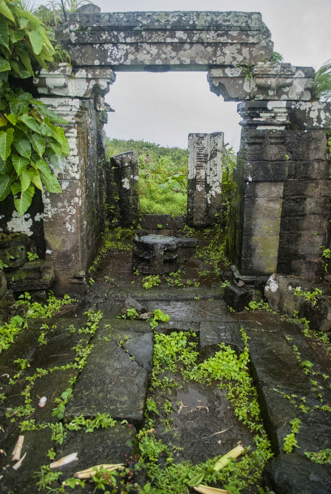
Before leaving the fort, we visited the Harishchandreshwar Temple. This is the main temple of the Fort.


Harishchandragad is one such place, not more than 150 kms from Pune. And it is because of its magnanimous Kokan Kada. It is aptly said to be भटक्यांची पंढरी in Marathi (means the Mecca of Wanderers / Trekkers).
Like thousands of Nomads in Maharashtra, visiting Harishchandragad had been in my mind every since my early college days when I had heard about its Kokan-kada from my friends then.
We started from Pune at 5.00 am. Taking other friends along we stopped for a breakfast at Narayangaon (on Pune-Nashik Highway - NH-50). At Narayanpur we took left towards Junnar and then to Khireshwar (off Khubi Phata). Last 4 kms along the Pimpalgaon Joga Dam is pathetic. The complete endurance testing of the vehicle suspension.
We reached Khireshwar, base village for Harishchandragad. We parked our vehicles there at a local hotel. Had some tea and started off our trek at 10.30 am.
It is a long trek. Takes about 5-6 hours to reach the top. It is not difficult, but definitely exhaustive. There is a small rock-patch, which is a slightly difficult portion. However, the whole trek-experience is just awesome. Passing over the large boulders, within a thick cover of green forest, difficult rock patches, etc was a bliss.
Route is like this (also explained the photo above) - Khireshwar to Tolar Khind. At Tolar Khind, another route from Kotul (Ahmednagar district) connects. This can be identified by stone sculpture of a tiger (व्याघ्रशिल्प). From here is the famous Rock Patch of Harishchandragad. After the Rock Patch, the route is quiet simple only without the tree cover. So far the route was through the dense trees.
2-3 more routes are there shown in map above. But these are extremely difficult. Not many are aware of these. Better to take a knowing person along these.
Being an exhaustive trek, the best way to reach here is winter season. Keep adequate amount of water. Since this has to be an overnight trek, some ready to cook food (like Maggi, Rice), utensils. Not to forget bedding as well.
We reached the Temple Complex at the top by 3.30 pm; after a rocking 5 hours. The Harishchandreshwar Temple is at the centre which comes to sight as we near the site. It is surrounded by few small temples, a big water body (a pond) and many caves. These caves are used for staying at night by the visitors here.
|
| Harishchandreshwar Temple |
We located a cave at the far end. Because of week-end, there was heavy rush and most of the caves were occupied. We were lucky to have one available; & that was awesome, with a water tank just next to it and a place in front to set-up our Chool (चूल) for cooking.
 |
| Caves on the top |
 |
| Temple Complex - view from top (enroute Kokan-kada) |
Kokan-kada is the place which has fascinated many trekkers for so many years. It faces the West & hence Sun-set is enduring here. So it has to be visited in the evenings to see the God going down. Only luck should be favoring and the clouds / fog can be spoil-sport.
When we visited, there was thick covering of clouds. We missed the sun-set. However, still this couldn't snatch away the beauty of the place.
The view from here is ... ... ... actually there are no words, no adjective can give justice to the beauty of this place, no noun can explain its awesomeness. I did click few photos, but even no photo could capture this place in completeness.
Kokan-kada is actually a "C" Shaped cliff and not just vertical, but also an overhang. Just like a hood of a Cobra. It is so high, the one cannot overlook down it, standing. One has to sleep-over and then lean; even that is frightening.
Some photos are below, however a caveat: these photos are nothing compared to the actual:
 |
| Cobra hood (overhang) is clearly seen here - taken by leaning over the cliff, my heart was pumping while doing this ... ;-) |
From here we turned back for our night abode. We had an awesome dinner prepared over a Chool (चूल) by burning the wood-sticks & twigs which we had collected during our return journey.
Night was chilly, however the cave where we were placed was covered, had sufficient place for 10 people & hence warmed-up. The flooring was, however, uneven. Not to forget, we had unexpected visitors - two large fully grown mice were in our cave while we were away at Kokan-kada. We had to frighten them out. And then during preparing our dinner, we had a snake, a small one. It slipped away in the woods.
After "peaceful" sleep, Kokan-kada was still calling us. We again headed there for one last visit before we leave. Filled it up in our eyes, mind, heart & soul and with actually a heavy heart, returned.
Before leaving the fort, we visited the Harishchandreshwar Temple. This is the main temple of the Fort.
Temple is built in Black Stone many centuries ago. It is said that Saint Changdev used to meditate in the caves here during 14th century. There is one stone inscription about Saint Changdev at the entrance of the temple.
Temple is surrounded by many caves & water cisterns. Trekkers use these spots for overnight stay.
On left side wall of the temple after you enter, there is the famous Ganesh idol. The orange colored idol with the back ground & surroundings of Black Stone looks beautiful. This photo is very famous on the internet.
River Mangal Ganga originates from one of the tanks near this temple. Little ahead of Harishchandreshwar temple by the side of this river is another interesting spot. Again, very famous photo on internet representing Harishchandragad - Kedareshwar Cave & Shiv-Linga. This is a huge cave with a huge Shiv-Linga at the centre surrounded by waist-deep water. Water is ice-cold. Really chilly.
Four pillars are built around Shiv-Linga. Legend says that 4 pillars represent each Yuga (Satyug, Tretayug, Dwaparyug & Kaliyug). When a pillar is destroyed, the Yuga ends. Kaliyug is the current phase. The day 4th pillar breaks down, it will be the last day of this era (world will come to an end).
 |
| Kedareshwar Cave & Shiv-Linga |
We started our return journey. Took the same route back. We reached Khireshwar at 4.30 pm. Since the ladies were still to come, we decided to visit Nageshwar temple which about a km from the village.
It holds a beautiful sculpture of Lord Vishnu in sleeping posture... Shesh-shayee.
 |
| Shesh-shayee Vishnu |
After stomach full of home made Pithala-Bhakari in the village, we started off our return journey at 6.00 pm. Reached home by 10.00 pm.