Thursday, 1 March 2012

Beautiful Bhandardara – February 25-26, 2012

This place, Bhandardara [भंडारदरा], was in my mind since 6 months now when one of my colleagues had visited it last monsoon. I had gathered the information about it and was waiting for an opportunity to explore the region.

And this opportunity came as part of a surprise to my wife on account of our wedding anniversary. I did the booking at MTDC last month and told her about the plan to celebrate this Anniversary Weekend somewhere outside Pune; however she was unaware of the venue (finally, I told her when we were 23 kms prior to Bhandardara).

We started off from Pune at 6.45 am and took the NH-50 (Pune-Nashik Highway). There are many routes to reach Bhandardara. The most common is from Sangamner [संगमनेर] and another one from Bota [बोटा] (just after Ale-Phata [आळे-फाटा]). There is one more (much longer) from Ale Phata and ahead of Malshej Ghat. All these routes are shown by Google Maps. However, I am not sure of the 3rd route from Malshej Ghat [माळ्शेज घाट].

I came across a much shorter route on one of the Team BHP blogs –
Pune-Narayangaon-Ozar-Otur-Brhmanwada-Kotul-Rajur-Shendi(Bhandardara).
The Route
This costed me about 176 kms (the shortest among other 3 routes mentioned above).

The drive was interesting. Small road turning through the fields on both sides, crossing over the hillocks through ghats. I enjoyed the drive. It was different than the mundane highway driving. It gave me the feeling of driving through the Western Ghats in Konkan.

Just after Narayangaon [नारायणगावा] on NH-50 there is a left turn to Ozar [ओझर] (Ashtavinayakas). We reached Ozar by 8.15 am. After a peaceful darshan of Vighneshwar [विघ्नेश्वर] and a breakfast, we cooched towards Otur [ओतूर]. At Otur we enquired for Brahman-wada [ब्राह्मण-वाडा]. The road goes straight ahead of Otur ST Stand.
Ojhar - Ashtavinayak

Ojhar - Ashtavinayak
At Brahman-wada, there is a “T” junction. Right will go back to NH-50 (Bota). We took Left. Then came Kotul [कोतुळ] and further ahead came Rajur [राजूर].

Ahead of Rajur there comes ascend towards left at Randha [रंधा] village (sign boards of MTDC and Anandvan resorts are available). This road goes to the village called Shendi [शेंडी] or Bhandardara.

Just before this ascend there is descend on Right towards Randha Waterfall. One can visit this before moving ahead. This will save your time of coming back again. Or else plan this while going back home.

Good amount of signage and boards are available for MTDC resort. The road goes through the Power Station, PWD Residential Colony, the Dam wall, Overflow gate, small bridges, etc. There are lots of Nilgiri Trees on both sides of roads. Large numbers of Bats are seen flocked on the branches of these trees all the day.

Sometimes in monsoon, the road near the overflow gate of the dam is completely under the water and hence is blocked. In this case, one needs to go straight ahead of Randha village (don’t take the Left ascent). Need to enquire to locals for the further way.

With 45 minutes break at Ozar we reached MTDC at 12.15 pm (4.45 hours / 176 kms).
We had booked Lake View Cottage. There were two rooms (a living room and a bedroom with attached toilet). Additional mattraces were available apart from a double bed and a sofa set in the living room.

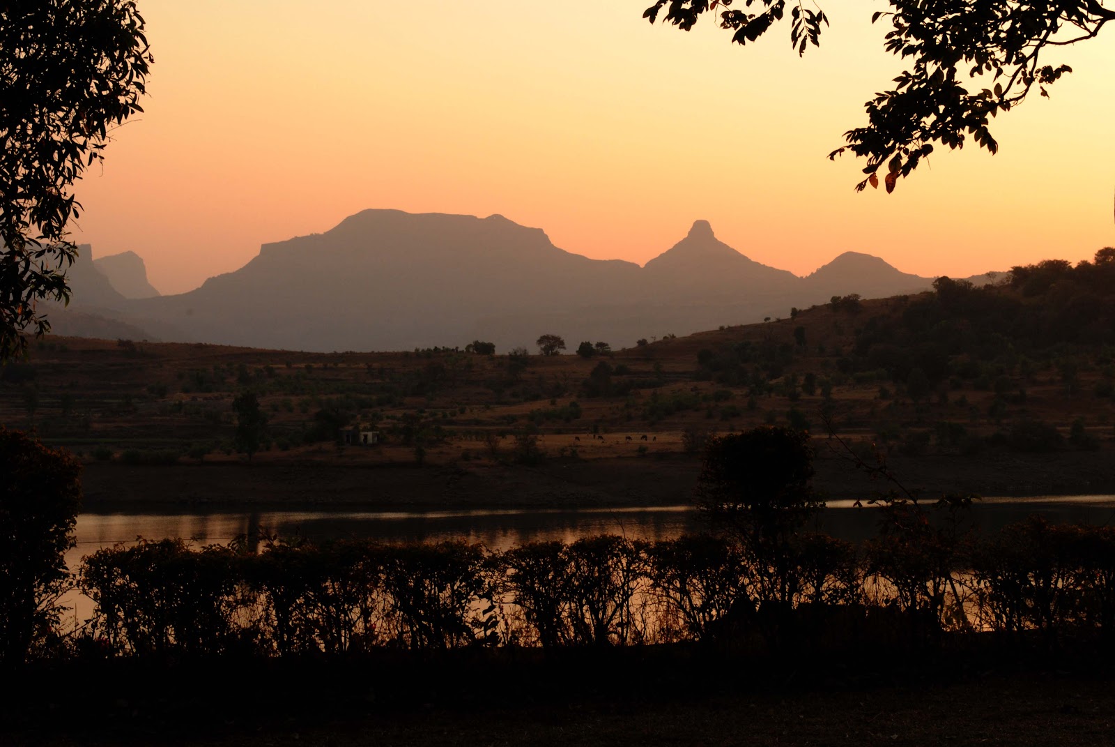
As the one at Ganpatipule and Malshej Ghat, this MTDC also scores for its location. Our cottage was just next to the lake. View from the verandah and the window was superb. I could see the beautiful lake in the front and complete Sahyadri Mountain Range at the background. I could see the fort Ratangad exactly opposite. In the evening we watched the Sun setting in front of us. 100 marks for the location. This view is not available to other resorts in the area (Yash Resort – 5000 Rs a day and Anandvan Resort – 10000 Rs a day).


The view:


It’s a no-frills place; basics only are available.
Room service is available with a 10% extra charge à Very bad!!!
Toilets were exceptionally clean.
Load shedding is a problem. When we reached our room, there was no electricity. Generator starts at 3.00 pm (???). Surprisingly, the ambient temperature was much cooler inside the room as compared to outside. At night we came to know that the fan is not working, tubelights have gone off. We complained, an electrician arrived, he tried to fix the problem; but in vain.
Food when we ordered in the afternoon was awesome (Veg Thali); however when we tried Punjabi Dish in the evening, it was pathetic. Breakfast (Omlet) and tea next morning was again – awesome.

I had heard that Guides are available near MTDC who take you around the place. We met one such person while checking in our room. I took his contact details.
After a brief nap in the afternoon, we called up that Guide – Vijay. We fixed up a rate of 400 Rs. for two days. There are two ways for sight-seeing – a short 22 kms to-and-fro for Wilson Dam, Arthur Lake, Over-flow Gate and Randha Falls AND a longer 55 kms to-and-fro around Bhandardara Dam catchment area (Arthur Lake).

We left at 4 pm for the shorter route first. We visited through the same route while coming from Pune some time back.

Wilson Dam: Named after a British Governor of the region. Built some time during 1910; construction took about 16 years to complete. It is built on Pravara [प्रवरा] River (also known as Amrutvahini in the region). The water catchment area is as wide as 25 kms and as deep as 260 feet.
Wilson Dam wall with Umbrella Falls on right
Umbrella Falls: When one of the sluice gates (on the Right side of the wall) is opened, the water that gushes out forms a shape of the Umbrella due to the shape of the rock below. Hence the name. It is visible in monsoons or when the dam gates are opened as per the irrigation requirements during the year. (our bad luck – the gates were opened just 2-3 days ago)

Arthur Lake: Named after the architect of the dam. It is the water body that is formed due to the catchment of Wilson Dam. Boating facilities are run by locals here. The sight of this lake surrounded by Sahyadri Mountains all around is mesmerizing.

Over-glow Gate: Little ahead of the Main Dam Wall, are the Over-flow Gates. These radial gates are used to maintain the required water levels. In monsoon, these gates are opened to its limit and still water overflows from the adjust walls passing through the bridge and road. This causes the blockage of road.

Randha Waterfall: Pravara River ahead of this dam descends roaring down into a beautiful gorge forming a Waterfall. Named after the village nearby. It is one of the leading waterfalls in India. It is available all-year-round. However the intensity in monsoons is magnanimous.

Honey-combs on rocks at Randha Falls; Tribals climb down
towards them to collect honey
By 6.00 pm, we reached our cottage. Watching the Sun set from your verandah is an awesome sight. Though the Sun sets everyday, you cannot witness it in your cities.

Next morning, we checked-out from MTDC at 9.00 am after our break-fast. We started off for the drive around the Bhandardara Dam. We again took the same road as yesterday till the Over-flow Gates. Then there is a Right towards Amruteshwar [अम्रुतेश्वर] Temple. This road comes under Forest Department surveillance. This is to avoid people from entering into hunting activities. One can find Rabbits, Foxes, Wolves and Leopards inside. Actually the area is the part of Kalsubai –Harishchandragad WildlifeSanctuary. There is charge of Rs. 50 per vehicle and Rs. 20 per person. However, if you visit the place before the schedule timing of the watchman’s arrival, you can visit inside without any ticket.

This drive is excellent. Small road turning in the forest covered with lush green trees; wheat fields were seen all around. Dried leaves were gushing behind due to speeding car wheels and watching this from rear view mirror of my car was priceless.
This road is around the lake with Sahyadris on to the left. We moved ahead of the village named Mutkhel [मुतखेल]. By 10 am, we reached the Amruteshwar Temple in the village of Ratanwadi [रतन-वाडी]. This is at the base of the fort Ratangad [रतन-गड].

Amruteshwar is the Shiva Temple built in Hemadpanthi style of architecture using black stone. It is about a century old. Some say that it is built in the era of Pandavas. References aside; the piece of art is awesome. Carvings inside and outside is beautiful. The black colored sculpture with a saffron flag flying on its top and the lush green back ground behind, makes this temple stand out as a Jewel in the area.

Amruteshwar Temple
Shiv-linga
Sculptures inside
This temple can also be reached through boat from Bhandardara. It’s about an hour’s ride and then a walk till the temple. This walk depends upon the water levels. We were told that we would need to walk about 3-4 kms (1 ½ hour) as the water levels are low.

Near the temple is the Jal-Kund [जल-कुंड] (Water Tank); again of black stone with carvings on it.

From here we moved ahead along the base of Ratangad. On our left was the grand fort of Maratha Empire while far away on right on other side the of lake I could see the tall peak of Kalsubai [कळसुबाई]. Leaving behind the village by the name Saamrad [साम्रद], we reached towards Kokan-Kada [कोकण-कडा] (not to be mistaken with the one on Harishchandragad [हरिश्चन्द्रगड]).
Ratangad
This is a place near Ghatghar [घाटघर] dam with no signs or boards around. It was the Guide with us hence we could trace it out. Else it is very difficult to identify the location. Locals might know about it; only there should be someone available to ask; we didn’t find anybody nearby.

This is place with “V” shaped rocks on both sides. Through which you can see a dam below – Chonda [चोन्दा] Dam. The view is beautiful; with strong winds flowing through.
The fun part is, the dam at the bottom is in Thane District. We were actually standing on the border of Ahmednagar District. Mumbai from here would be very close by. However, sadly, there is no road-route available yet.
Kokan-kada
From here, we moved ahead around the Ghatghar Dam walls towards Panjare [पांजरे] village. This is the base village for Mount Kalsubai. From here the Maharashtra’s tallest peak stands tall (1646 meters / 5500 feet above seal level) just next to you. You can see the red dot of the temple on the top of the peak.
Mount Kalsubai
From here we moved ahead towards our base camp, MTDC. We reached back by 11.30 am after completing a full circle of about 55 kms around Bhandardara Lake. Our route was Shendi-Mutkhel-Ratanwadi-Saamrad-Ghatghar-Panjare-Shendi.

When enquired at MTDC Canteen for lunch, it was not yet ready (lunch starts at 12). Nothing else was available to eat. We therefore had lunch at hotel nearby – Sonali. There is one more by the name Vaibhav. I had heard that these two serve good rice plates (Veg/Nonveg). Sonali was definitely good. But I felt it was costly at Rs. 70 per plate.

By 12.30 pm we started our way towards Pune. This time we decided to take the more busy and common Sangamner route. There is a Left just after Rajur towards Akole [अकोले]. This road meets the NH-50 (Pune-Nashik Highway) at Sangamner.

By 3.15 pm we were at Daulat drinking Watermelon Joice and by 6.30 pm, we were at the comforts of our home.

Coordinates of the place: 19° 33' 08.00" N   73° 45' 20.66" E


Odometer readings:

Day 1:-
0 kms     Pune (Narayan Peth)
13          Nashik Phata
24          1st Toll Point on NH-50 (Near Chakan)
43          2nd Toll Point on NH-50 (Near Rajgurunagar)
46          Rajgurunagar
66          Manchar
80          Narayangaon
91          Ozhar
100        Otur
116        Brahman-wada
133        Kotul
152        Rajur
166        Take the ascent on Left (look for boards of Anandvan and MTDC Resorts)
176        Shendi village (Bhandardara)
201        Sight-seeing at Bhandardara – Wilson Dam, Arthur Lake, Randha waterfall - total of 25 kms

Day 2 :-
257        Sight-seeing at Bhandardara – Amruteshwar temple (at Ratanwadi), Kokan-kada, Ghatghar dam, Kalsubai peak (base village) – 56 kms (around the Arthur lake)

281        Rajur
285        Take Left towards Akole, Sangamner
302        Akole
325        Sangamner
362        Daulat Restaurant (on NH-50)
476        Pune (Narayan Peth)


Thursday, 23 February 2012

Bhandara Hill - February 22, 2012

A day before (on 21st) at 5 pm while leaving from office, Bala told that we are planning for a outing tomorrow. Nothing else was decided.
Next day (on 22nd) I reached office prepared (in my car for the drive, extra pair of sport shoes - if required for the trek and the camera). Couple of people backed out due to some other priorities, however, we 4 made it.

We decided for Bhandara Hill - again near Dehu, like last time we visited on February 8, 2012.

We started off by 5.15 pm after our office hours through the same route as our earlier trip. We reached Dehu village. Stopped for the brief photography.
Tukaram Gatha Mandir (Temple) at Dehu - on the banks of Indrayani


After this bridge comes the Talegaon-Chakan By-pass. Last time we went towards right. This time we took Left here. Immediately when we headed towards Chakan, we could see the Hill on right side - that's the Bhandara Hill.

Bhandara Hill - as seen from Talegaon-Chakan bypass
There's one toll (25 Rs.). We told the person there that we are going to Bhandara Hill. He informed us that the same receipt can be utilized while returning. One can just try to avoid this toll if he can pass-by as a local from the area. One needs to have that confidence in talking that way.  ;-)

Withing 1/2 a km after the toll is the rectangular arch constructed (pink colored) on the Right. This place is called a Indoori. We took that road.

This road goes on the hill. Road is extremely wide, newly tarred; actually some patch is still under construction. But the drive upwards is excellent. It must be pleasure to drive in monsoons.

On the top is there is a small temple with the idols of Tukaram Maharaj; apart from Vitthal-Rakhumai, Lord Ganesha and others. There is this large tree in the shade of which Tukaram Maharaj used to sit for his prayers. Parking space is ample. There are couple of snacks centers which would serve atleast Chai if nothing else. We got only Chai-Biscuits; nothing else was available.

We spoke with some locals there. It is said that the historic meeting between Saint Tukaram and Chhatrapati Shivaji happened at this very place.

By 7.00 pm we decided to get back. On our way back, we halted at the Tukaram Gatha Mandir at Dehu (refer 2nd photo from top). We did the mistake here. We should have gone here first and then we should have proceeded for Bhandara Hill. By the time we reached at 7.20 pm it was all dark already and couldn't see the beauty of it.
Gatha Mandir - this one I took with shutter speed of 1.6 seconds; hand-held
Next time I will definitely visit here during the daylight.
Coordinates for the places are:-

Bhandara Hill:              18° 45’ 06.38” N   73° 43’ 58.72” E
Gatha Mandir:              18° 43’ 39.53” N   73° 46’ 06.12” E


Thursday, 9 February 2012

Bhamchandra Gad / Dongar (Hill) - February 8, 2012

My new set of colleagues from my new department (I changed by department in Oct-11) planned to visit an unexplored site called Bhamchandra Gad / Dongar (that’s Hill in Marathi). One of our experience trekkers, Mr. Ashutosh Jayawant, suggested this place; and we were all game to it.
When we were told about this place, we were all ignorant and so was Google. When I tried to google this place, what I came to know was some news related to villagers’ agitations against the industrialization and couple of name references on sites of MTDC, Wikipedia and Facebook. Even Google Maps doesn’t show this place. There was not a single blog; except some guy had posted a 90 secs video on some site. My this blog might be the first one.

On Wednesday of January 8, 2012 evening after office hours, we started off for Bhamchandra Gad. We left our factory at Chikhli at 5.15 pm. We reached at the bottom of the hill by 6.15 pm. The final part of road is pathetic. It’s a muddy road with stones around, extremely uneven. At one point my Car was hit at the underbody. Luckily nothing seems to have happened. If time is available, its better to park the car prior to this muddy road starts and get walking.

There are two ways to reach the top. Take the car till the end of the road – ensuring its torture testing as mentioned above – and start climbing (enjoy the trek). Else park the car prior and take a relatively lower slope, but a longer route.
Enroute

Enroute
Our destination - Bhamchandra Hill
The Group
After couple of photography pit-stops, we reached the top by 6.45 pm. There is the Lord Shiva Temple cut in the caves. Ahead of that there are about 20-25 stairs which go to Lord Vithal Temple, again rock cut. It has Saint Tukaram carved on one side; as if chanting.


Final steps towards the top


Legend has it that, Saint Tukaram used to come here for his prayers. It must have been the peaceful ambience that provided him the required sanctity and piety for his verses. One can witness the same even today – the peace and beauty in the environment.


If you need to experience this mood, I think you should plan a visit in the coming 2 years or so. Because, we saw many industries are coming up on the way from Dehu to this place. This is definitely going to do a complete make-over and the things would not be the same again.

Unfortunately, there are no odometer readings this time. The reason is we started-off from my company at Chikhli. However, there is a different route from Pune (shown in the map below). It is about 45-50 kms from Pune (a very good half a day trip).

Just note that there is a very photogenic location by the bridge on River Indrayani near Dehu. Just take some time to satisfy you photography buds. I couldn’t this time, as we were running late and could have missed the sunset photographs. However, I have decided that I am going to come just at this place to take come snaps.

Route:
Pune – take NH-4 (Mumbai-Pune Old Highway)
Leave Kasarwadi (Nashik Phata), Pimpri, Chinchwad, Nigdi.
Dehu Road – Just prior to Dehu Road, there is a Right towards Dehu. Take that.
Go ahead of Dehu, cross the bridge on River Indrayani.
Join Talegaon-Chakan Road and take Right.
Ask for Hyundai Chowk (named after Hyundai Construction Equipments Company) and take Left (Village Savardari) – You can see the Hyundai Plant and Tetra Pak Plant on Left.
Vasuli Naka, Bhamburle village – Take left.

The hillock seen in front is our destination. An extremely muddy and pathetic road will go towards left. Take that. If you can, park the vehicle there and go by walking. Or else need to take the vehicle very cautiously and carefully so that nothing hits its underbody.
Coordinates given above might not show the exact location; however, a fair idea can be sought.

Sunday, 5 February 2012

Recap 2011

Year 2011 started off with a resolution of maintaining an online travelogue through blogging - this was to maintain a record for myself and to help other fellow travellers plan their trip; in a way I am doing so and taking online help when I plan for one.

So I penned down the first post for Diveagar-Harihareshwar trip that we did in Mar-2010 with my Tata Motors colleagues.

2011 brought with it two trips, both in January 2nd week. Alibag-Janjira again with my TML colleagues and then trip to Lavasa at the backyard of Pune with Manjiri and Arnav.

In Mar-2011, our Photography Club had planned an excursion to Kihim Beach. So here I was visiting Alibag again within a span of 2 months.

Then there was a lull period for the two quarter almost. Monsoons brought with it loads of opportunity for "excavations" around. In Jul-2011 we went to Thoseghar Waterfalls near Satara. We tried to see the Chalkewadi Windmills also; however, we were not able to see them effectively due to heavy fog. Next we shall give it a try again. Then 4 days later, we went again to Lavasa with two of my TML colleagues. The place had transformed like anything due to monsoons than last time we visited in January.

1st week of Aug-2011 also had another Photography Club excursion; this time to Mahabaleshwar - to capture the natural ecosystem (theme for our photography). We coupled the 15th August holiday for a family visit to my cousin at Badalapur (near Karjat). From there we went to a Waterfall at a nearby village named Savroli.

Again the same 3 of us (TML guys) planned a short Thursday outing to Panshet-Varasgaon Dams near Pune in the 1st week of Sep-2011. In the 3rd week we 3 along with 5 others went to Malshej Ghat. This was a distinct promotion party instead of the regular restaurant types.

Oct-2011 was our already long planned family trip to our native in Konkan. 3 days coupled with Diwali holidays was an experience that we can cherish.

This way year 2011 came with in all 10 trips. I don't remember I have traveled  to so many places in a year earlier.

Next year atleast I should target for a trip a month. Many places are on cards - Kaas, Bhandardara, Ajanta-Ellora (Aurangabad), Ramdara, Bhuleshwar, Morachi Chincholi, Ranjan-Khalge. Lets see how it all fares.

Happy travelling!!!